Online Groundwater Models
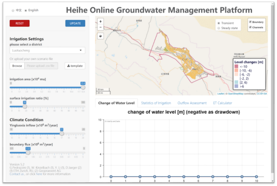
Under the links below you find two web-based interactive groundwater modeling tools. In the Heihe model app you can adjust surface water and groundwater allocation in 21 irrigation districts of Heihe Mid-reach Basin in order to keep cones of depression small and to satisfy the river outflow requirement.
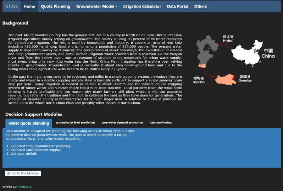
The Guantao model app is a more comprehensive decision support tool including an optimizer for groundwater allocation given a user-chosen red line, an irrigation calculator, a box-model water-balance of Guantao County and a 2D model of the shallow aquifer beneath Guantao. In the 2D model, surface water and groundwater irrigation can be allocated in 9 sub-areas. In addition, infiltration ponds can be installed. The model shows the resulting head distribution and compares the distance to groundwater to the user-prescribed red line.
Follow these links (use "guest" for username and password):
Background
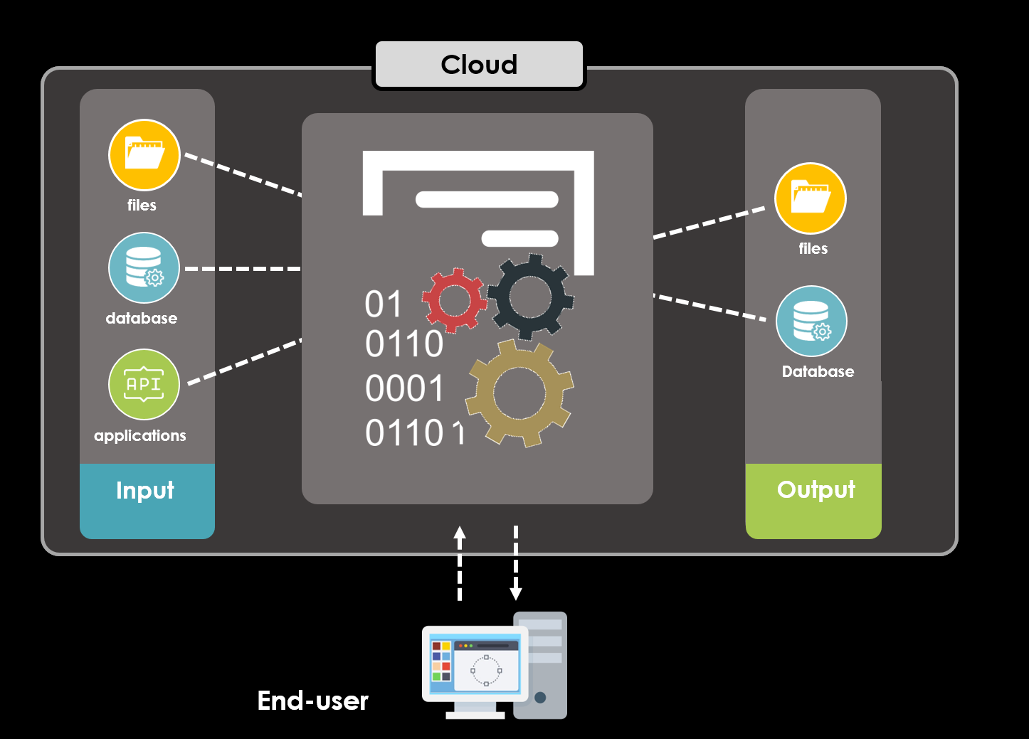
The physically based groundwater model is an essential tool for providing a comprehensive and detailed pictures of the system’s possible evolution under different scenarios of water use. It allows to evaluate possible alternatives to present water allocation. Yet, the technical requirements to use such a model may be beyond the capacity of the decision makers in the water authorities. To close this gap, we developed online groundwater simulation tools with the goal of facilitating the application of groundwater model while keeping a minimal technical requirement on modeling and hydrogeological expertise.
The novelty concerns the fact that the groundwater model is embedded in an interactive web-interface and accessible to users through internet with all standard web browsers of computers, tablets or even smartphones. Users can perform a scenario assessment on the fly by, e.g., modifying the present allocation strategy and visualizing results of interest such as projected changes of groundwater levels. The Guantao model app further integrates other modeling tools and database to deliver a comprehensive decision support system.

What can you do
Heihe model app
- Planning for water allocation with groundwater models;
- Visualize simulation results for grounddwater head, water use statistics, compliance with target outflow, etc.
- Estimate crop ET for main crops in Heihe;
Guantao model app
- Perform red-line based water quota planning with box model and stochastic dynamic programming;
- Simulate groundwater head with numeric model and box model;
- Estimate crop water demand using crop model;
- Visualization of various observation data;
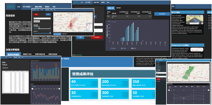
Screenshots of online groundwater apps
Dissemination
The Apps have been first launched in the beginning of November 2016. The Heihe app was officialy presented at the external page Swiss Geoscience Meeting 2016 in Geneva on November 19th and at the external page AGU Fall Meeting 2016 in San Francisco on Friday December 18th.
The Heihe app has been introduced to the decision-makers in the Heihe Basin by the end of project phase I in 2018. The Guantao app will be transferred to the local water resource bureau by the end of 2019.


